
Promotional Material

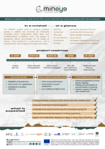
Newsletter
Want early access?
Sign up here today to our mailing list and be the first to receive all project updates and many more…


Publications
- V. Kopačková-Strnadová, "Monitoring Acid Mine Drainage in the Rio Tinto Region of Spain Using Machine Learning and S-2 Global Reflectance Mosaic (S2GM-2 Service)," IGARSS 2025 - 2025 IEEE International Geoscience and Remote Sensing Symposium, Brisbane, Australia, 2025, pp. 4123-4127, doi: 10.1109/IGARSS55030.2025.11243369.
- C. Senaras, K. Roth, M. Grady and A. Wania, "Super-Res Tanager: A Deep Learning Based Sharpening Approach For Tanager Hyperspectral Images," IGARSS 2026 - 2026 IEEE International Geoscience and Remote Sensing Symposium, Washington DC, DC, USA, 2026, pp. 1166-1170, doi: 10.1109/IGARSS60577.2026.11728279.
- Ullah, Irfan, et al. "An Integrated Remote Sensing Approach to Lithological Mapping and Critical Raw Material Exploration in the South Portuguese Zone, Spain." Mining Revue, vol. 32, no. s1, University of Petrosani, 2026, pp. 149-159. https://doi.org/10.2478/minrv-2026-0038.
Deliverables
Compilation, collection and management of multidisciplinary and multi-scale EO data for the entire mining value chain
| D1.1 | EO database | PUBLIC |
Statistical and ML methods in greenfield and brownfield exploration
| D2.1 | ML-based Mineral Potential Map (MPM) | PUBLIC |
| D2.2 | 3D Model | SENSITIVE |
Mineral extraction and global stability of mines
| D3.1 | Digital platform of global stability | SENSITIVE |
Tailing environmental footprints and secondary raw materials re-mining
| D4.1 | Inventory Map (IM) | PUBLIC |
| D4.2 | Remining Potential assessments and environmental indices | PUBLIC |
Data fusion and model validation for mine value chain
| D5.1 | Data Fusion guideline | SENSITIVE |
| D5.2 | IPOP testing & validation report | SENSITIVE |
Sustainability Impact Analysis (IA) and Strategic Roadmap for Implementation
| D6.1 | Summary Report on Sustainability of MINEYE technology | PUBLIC |
Communication, Dissemination and Exploitation
| D7.1 | Communication and Dissemination Plan | PUBLIC |
| D7.2 | Communication and dissemination toolkit | PUBLIC |
Project management
| D8.1 | Project Management Plan | SENSITIVE |
| D8.2 | Detailed data management plan | SENSITIVE |
| D8.3 | IPR management plan | SENSITIVE |
Compilation, collection and management of multi-disciplinary and multi-scale EO data for the entire
| D9.1 | Final EO database | PUBLIC |
| D9.2 | Ground and Sensor-based database | SENSITIVE |
Mineral extraction and global stability of mines
| D10.1 | Ground stability and displacement measurements | SENSITIVE |
Sustainability Impact Analysis (IA) and Strategic Roadmap for Implementation
| D11.1 | Final Summary Report on Sustainability of MINEYE Technology | PUBLIC |
Communication, Dissemination and Exploitation
| D12.1 | Market analysis, needs, trends and the products proposition | SENSITIVE |
| D12.2 | Collaboration activities and engagement report | PUBLIC |
| D12.3 | Exploitation & Sustainability Strategy, MINEYE Business Canvas and IPRs | SENSITIVE |
Project Management
| D13.1 | Final MINEYE report | PUBLIC |
Tools & Results
As a result of Work Package 2 “Statistical and ML methods in greenfield and brownfield exploration”, methods and tools have been developed for probabilistic 3d modelling and joint inversion of Earth Observation and Geophysical Data. You can find the workflows and examples here and the full source-code is available here.